Unnamed resource
URL: https://daac.ornl.gov/CMS/guides/Howland_Forest_Biomass_Map_V2_Fig1.png
Dataset description:
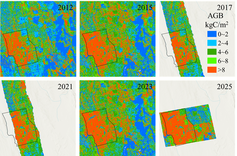
This dataset provides aboveground biomass (AGB) maps at 10-m spatial resolution for the Howland Research Forest in central Maine for the years 2012, 2015, 2017, 2021, 2023, and 2025....
Source: Aboveground Biomass Maps for Howland Research Forest, Maine, 2012-2025
Additional Information
| Field | Value |
|---|---|
| Data last updated | June 3, 2026 |
| Metadata last updated | June 3, 2026 |
| Created | June 3, 2026 |
| Format | PNG |
| License | other-license-specified |
| Datastore active | False |
| Has views | True |
| Id | 06c00408-0767-4091-a720-8509927dbbb9 |
| Mimetype | image/png |
| Package id | 07185d51-ef7f-42eb-888b-5f9a16f2a305 |
| Position | 3 |
| State | active |
| Tracking summary | {'total': 0, 'recent': 0} |