Get a related visualization
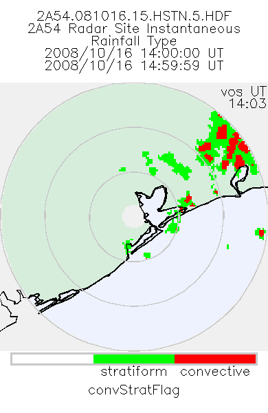
URL: https://docserver.gesdisc.eosdis.nasa.gov/public/project/GPM/browse/2A54_BR.081016.15.HSTN.5.PNG
Dataset description:
'Radar Site Convective/Stratiform Map', is an instantaneous map in Cartesian coordinates with a 2 km resolution. At single radar sites, the map covers an area of 300 km x 300 km. For the...
Source: TRMM Ground Validation Radar Site Rain Type Map L2 1 hour 2 km V7 (TRMM_2A54) at GES DISC
Additional Information
| Field | Value |
|---|---|
| Data last updated | March 31, 2025 |
| Metadata last updated | March 31, 2025 |
| Created | March 31, 2025 |
| Format | PNG |
| License | License not specified |
| Datastore active | False |
| Has views | True |
| Id | b01669a3-505c-4adb-a4db-0e300ee1bf9b |
| Mimetype | image/png |
| Package id | 8da69e34-a65f-44f4-b6e1-8e46732f10c7 |
| Position | 0 |
| State | active |
| Tracking summary | {'total': 0, 'recent': 0} |