Unnamed resource
URL: https://daac.ornl.gov/ABOVE/guides/ReSALT_ALT_GPR_Fig1.png
Dataset description:
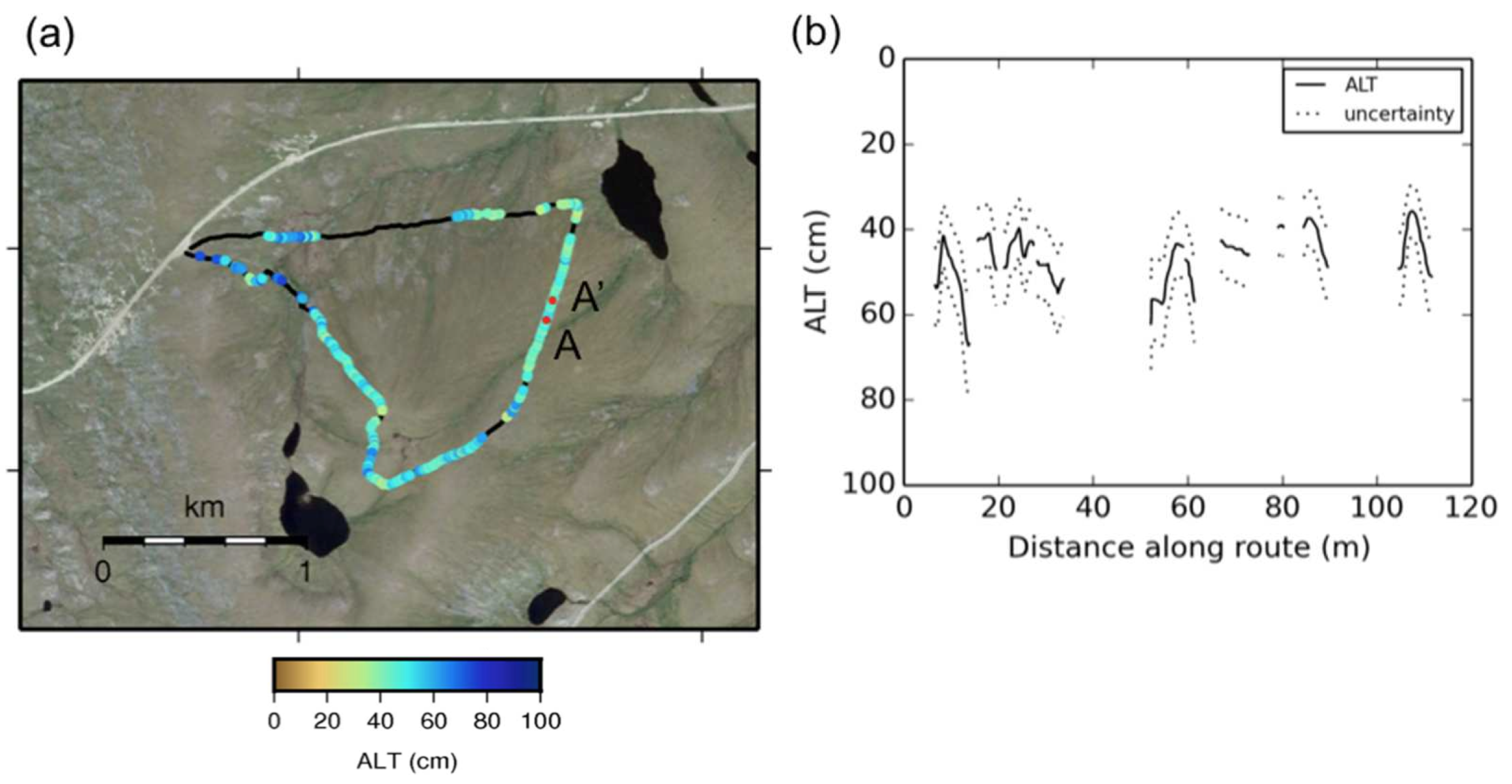
This data set includes estimates of permafrost Active Layer Thickness (ALT; cm), and calculated uncertainties, derived using a ground-penetrating radar (GPR) system in the field in August...
Source: Pre-ABoVE: Ground-penetrating Radar Measurements of ALT on the Alaska North Slope
There are no views created for this resource yet.
Additional Information
| Field | Value |
|---|---|
| Data last updated | August 21, 2025 |
| Metadata last updated | March 10, 2026 |
| Created | August 21, 2025 |
| Format | PNG |
| License | other-license-specified |
| Datastore active | False |
| Has views | False |
| Id | 65ebc712-1424-44b1-a304-c06322935de5 |
| Mimetype | image/png |
| Package id | 674d3409-4c6d-4394-ad6d-b19f79072933 |
| Position | 3 |
| State | active |
| Tracking summary | {'total': 1, 'recent': 1} |