Get a related visualization
URL: https://daac.ornl.gov/CMS/guides/CMS_Monthly_CO2_Gulf_of_Mexico_Fig1.png
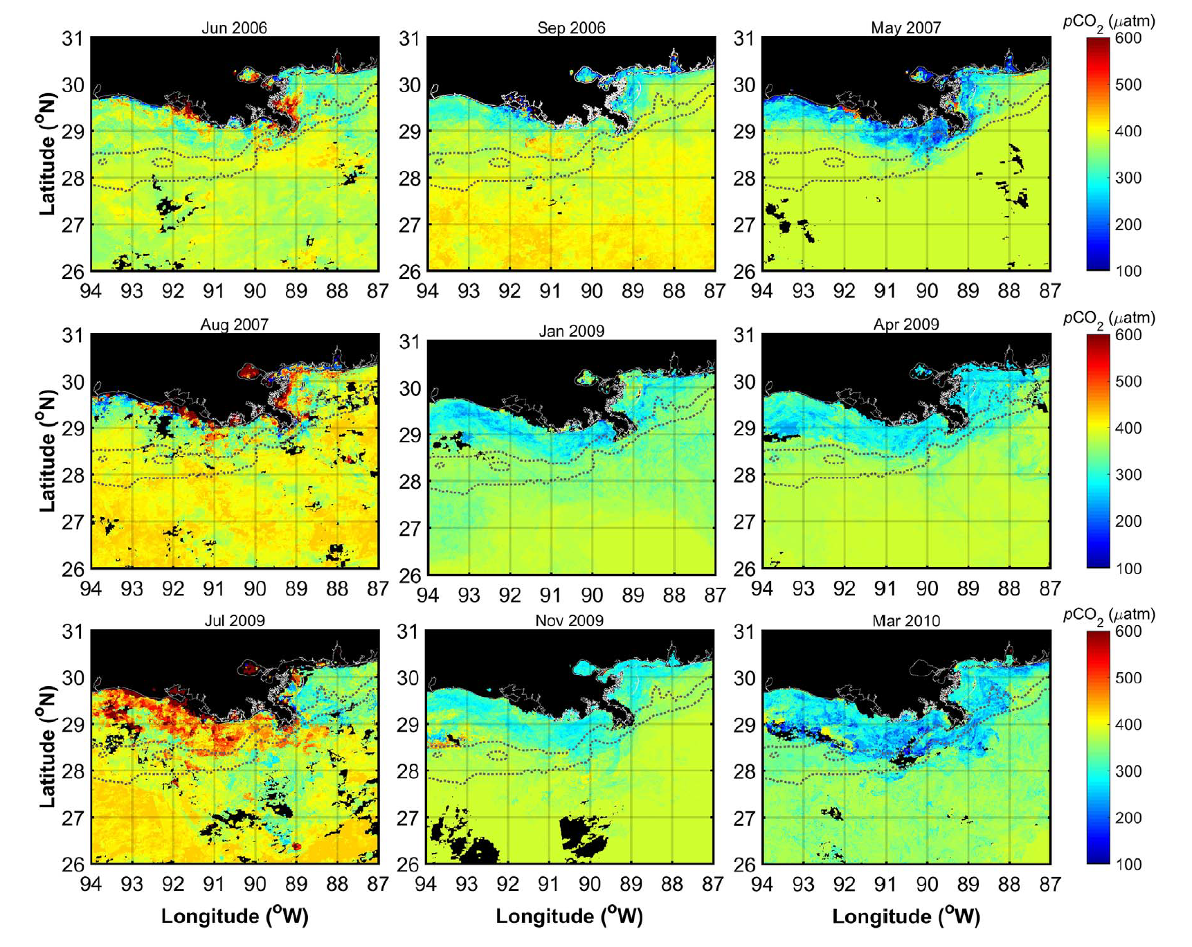
Monthly composite images of satellite-derived pCO2 for the northern Gulf of Mexico, corresponding to each of the cruises for which observational data were acquired. Black pixels in the images correspond to areas that were masked (e.g., land, clouds), and the dotted lines represent the 45 and 200 m isobaths. From Lohrenz et al. (2018).
Additional Information
| Field | Value |
|---|---|
| Data last updated | unknown |
| Metadata last updated | April 23, 2025 |
| Created | unknown |
| Format | PNG |
| License | License not specified |
| Created | 2 years ago |
| Media type | image/png |
| Datastore active | False |
| Has views | True |
| Id | c281dc2c-a7ee-42cf-8780-dafc40f53c3f |
| Package id | 2948d800-1267-43ba-8413-29e3ccb6469e |
| Position | 5 |
| State | active |
| Tracking summary | {'total': 2, 'recent': 1} |