Data Information (JPEG)
URL: https://daac.ornl.gov/MASTER/guides/MASTER_Flightline_Locator_Fig1.jpg
Dataset description:
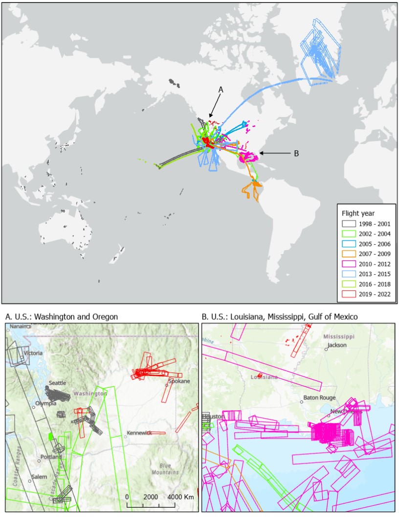
This dataset provides resources for identifying flight lines of interest for the MODIS/ASTER Airborne Simulator (MASTER) instrument based on spatial and temporal criteria. MASTER first...
Source: MASTER: Flight Line Geospatial Polygons and Contextual Data
There are no views created for this resource yet.
Additional Information
| Field | Value |
|---|---|
| Data last updated | August 21, 2025 |
| Metadata last updated | August 21, 2025 |
| Created | August 21, 2025 |
| Format | JPEG |
| License | License not specified |
| Datastore active | False |
| Has views | False |
| Id | 2bc577b8-ec57-4ce8-9575-d099a43f0daa |
| Mimetype | image/jpeg |
| Package id | 4404443e-c7bf-46bf-97ac-dbba3304a19e |
| Position | 3 |
| State | active |
| Tracking summary | {'total': 1, 'recent': 1} |