Unnamed resource
URL: https://daac.ornl.gov/ABOVE/guides/Kuparuk_Veg_Maps_Fig1.png
Dataset description:
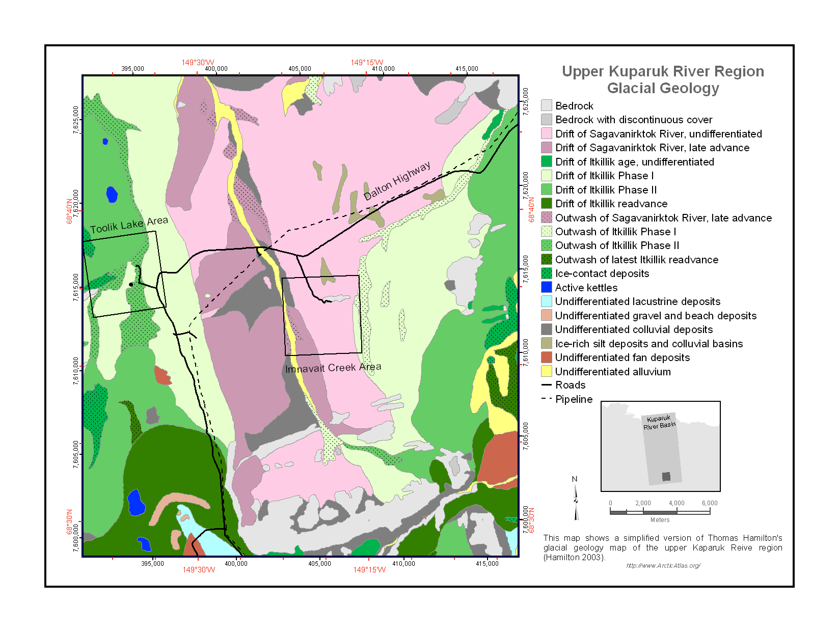
This data set provides a collection of vegetation, landscape, geobotanical, elevation, hydrology, and geologic maps for the Kuparuk River Basin, North Slope, Alaska. The maps cover either...
Source: Maps of Vegetation Types and Physiographic Features, Kuparuk River Basin, Alaska
There are no views created for this resource yet.
Additional Information
| Field | Value |
|---|---|
| Data last updated | August 21, 2025 |
| Metadata last updated | March 10, 2026 |
| Created | August 21, 2025 |
| Format | PNG |
| License | other-license-specified |
| Datastore active | False |
| Has views | False |
| Id | bb6b87e9-af96-4705-9807-492cc4e97263 |
| Mimetype | image/png |
| Package id | 7f868377-ac9a-43d0-894f-09811ad9b2fb |
| Position | 3 |
| State | active |
| Tracking summary | {'total': 0, 'recent': 0} |