Unnamed resource
URL: https://daac.ornl.gov/HYTES/guides/HyTES_L2_Emissivity_Overlays_Fig1.png
Dataset description:
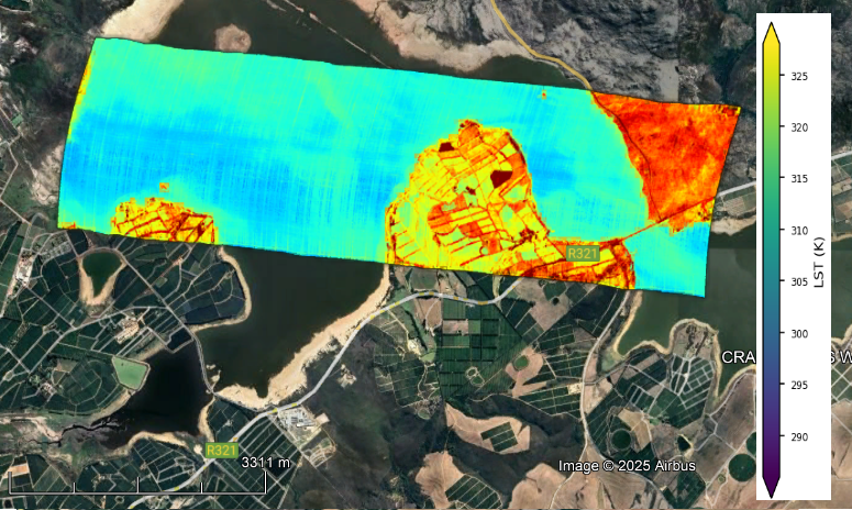
This dataset contains geocorrected image overlays of Level 2 (L2) emissivity and land surface temperature (LST) from imagery acquired by the Hyperspectral Thermal Emission Spectrometer...
Source: HyTES Level 2 Emissivity and LST Overlay Images, Facility Instrument Collection
Additional Information
| Field | Value |
|---|---|
| Data last updated | unknown |
| Metadata last updated | August 18, 2026 |
| Created | unknown |
| Format | PNG |
| License | other-license-specified |
| Created | 2 months ago |
| Media type | image/png |
| Datastore active | False |
| Has views | True |
| Id | 0120f7f0-d6a1-4f62-91e6-a3a4e1c14315 |
| Package id | b44ab6ba-4527-4275-b3b8-b9553d5a80f7 |
| Position | 2 |
| State | active |
| Tracking summary | {'total': 1, 'recent': 1} |