Unnamed resource
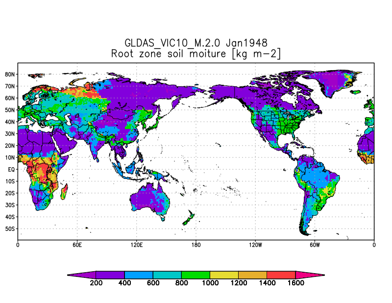
URL: https://docserver.gesdisc.eosdis.nasa.gov/public/project/Images/GLDAS_VIC10_M_2.0.png
Dataset description:
NASA Global Land Data Assimilation System Version 2 (GLDAS-2) has three components: GLDAS-2.0, GLDAS-2.1, and GLDAS-2.2. GLDAS-2.0 is forced entirely with the Princeton meteorological...
Source: GLDAS VIC Land Surface Model L4 monthly 1.0 x 1.0 degree V2.0 (GLDAS_VIC10_M) at GES DISC
There are no views created for this resource yet.
Additional Information
| Field | Value |
|---|---|
| Data last updated | March 10, 2026 |
| Metadata last updated | March 10, 2026 |
| Created | March 10, 2026 |
| Format | PNG |
| License | other-license-specified |
| Datastore active | False |
| Has views | False |
| Id | faf36841-7818-4163-a3e2-9d0872577769 |
| Mimetype | image/png |
| Package id | 77b180aa-2689-44d8-8c59-6a6993b54561 |
| Position | 0 |
| State | active |
| Tracking summary | {'total': 0, 'recent': 0} |