Unnamed resource
URL: https://daac.ornl.gov/CMS/guides/CMS_Global_Mangrove_Forest_Ht_Fig1.png
Dataset description:
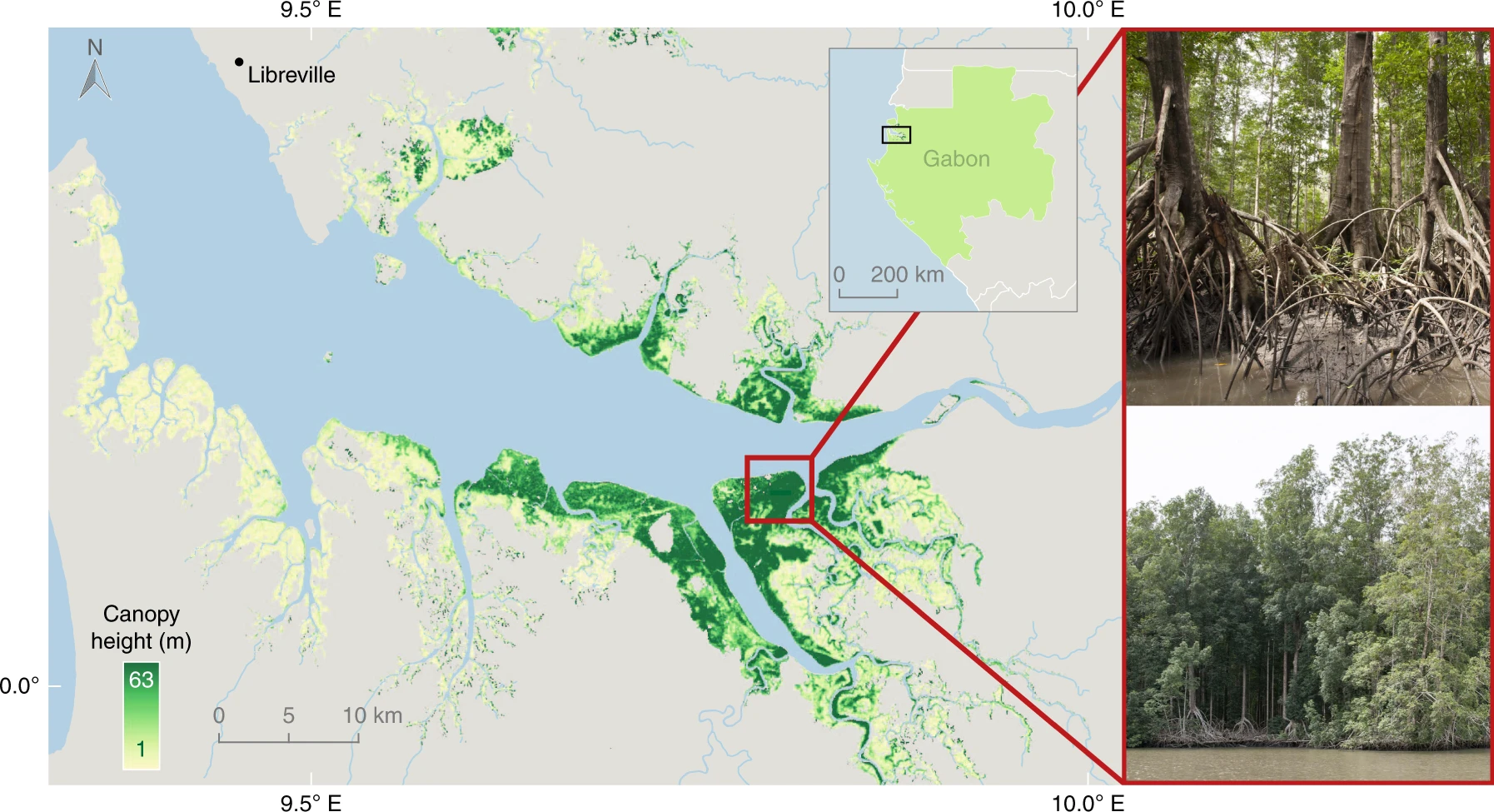
This dataset characterizes canopy heights of mangrove-forested wetlands globally for 2015 at 12-m resolution. Estimates of maximum canopy height (height of the tallest tree) were derived...
Source: CMS: Global Mangrove Canopy Height Maps Derived from TanDEM-X, 2015
There are no views created for this resource yet.
Additional Information
| Field | Value |
|---|---|
| Data last updated | August 21, 2025 |
| Metadata last updated | March 10, 2026 |
| Created | August 21, 2025 |
| Format | PNG |
| License | other-license-specified |
| Datastore active | False |
| Has views | False |
| Id | 6585f3be-0ea6-460b-96aa-93a43e8fe970 |
| Mimetype | image/png |
| Package id | bd0ee0d8-a78e-4539-97d9-b482ef8e429e |
| Position | 3 |
| State | active |
| Tracking summary | {'total': 0, 'recent': 0} |