Unnamed resource
Dataset description:
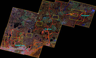
The objective of this land cover mosaic is to provide a data product that characterises the detailed land cover of a significant portion of the BOREAS Region. Seven Landsat-5 TM images...
Source: BOREAS Follow-On DSP-01 Landsat TM Land Cover Mosaic of the BOREAS Transect
There are no views created for this resource yet.
Additional Information
| Field | Value |
|---|---|
| Data last updated | unknown |
| Metadata last updated | March 9, 2026 |
| Created | unknown |
| Format | JPEG |
| License | other-license-specified |
| Created | 1 year ago |
| Media type | image/jpeg |
| Datastore active | False |
| Has views | False |
| Id | 85d32525-671a-4c07-83e6-64f8183e9b24 |
| Package id | e7232b0b-d81a-486c-905a-2809b2dba676 |
| Position | 6 |
| State | active |
| Tracking summary | {'total': 0, 'recent': 0} |