Unnamed resource
URL: https://docserver.gesdisc.eosdis.nasa.gov/public/project/Images/LPRM_AMSRE_D_SOILM3_002.png
Dataset description:
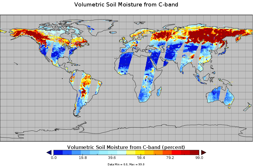
AMSR-E/Aqua surface soil moisture (LPRM) L3 1 day 25 km x 25 km descending V002 is a Level 3 (gridded) data set. Its land surface parameters, surface soil moisture, land surface (skin)...
There are no views created for this resource yet.
Additional Information
| Field | Value |
|---|---|
| Data last updated | March 9, 2026 |
| Metadata last updated | March 9, 2026 |
| Created | March 9, 2026 |
| Format | PNG |
| License | other-license-specified |
| Datastore active | False |
| Has views | False |
| Id | f61e42d8-50f5-4eda-a2cc-09d3ac06973d |
| Mimetype | image/png |
| Package id | 34d99c72-6bc5-4ed3-bd10-2d56d9766bb0 |
| Position | 0 |
| State | active |
| Tracking summary | {'total': 0, 'recent': 0} |