Unnamed resource
URL: https://daac.ornl.gov/AFRISAR/guides/Polarimetric_height_profile_Fig1.png
Dataset description:
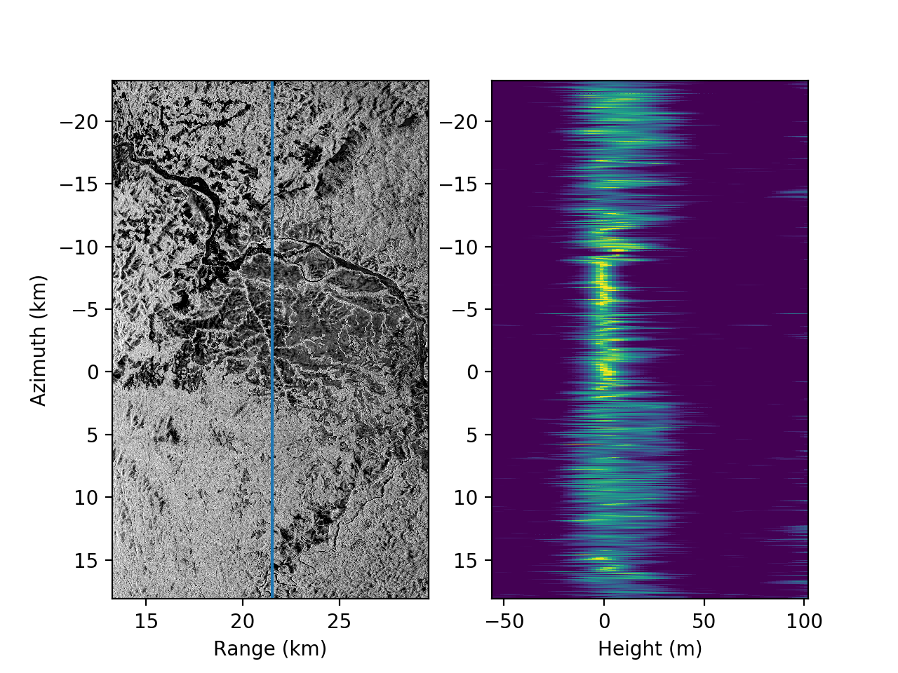
This dataset provides height profiles derived from UAVSAR (Uninhabited Aerial Vehicle Synthetic Aperture Radar; JPL) data acquired over Lope National Park and Rabi Forest in Gabon as part...
Source: AfriSAR: Polarimetric Height Profiles by TomoSAR, Lope and Rabi Forests, Gabon, 2016
There are no views created for this resource yet.
Additional Information
| Field | Value |
|---|---|
| Data last updated | August 21, 2025 |
| Metadata last updated | March 9, 2026 |
| Created | August 21, 2025 |
| Format | PNG |
| License | other-license-specified |
| Datastore active | False |
| Has views | False |
| Id | de2ebc50-a82d-4cd7-80e6-5e7dc54c2980 |
| Mimetype | image/png |
| Package id | 7ca346e2-7dd1-4f5c-9770-801b4757c4e1 |
| Position | 4 |
| State | active |
| Tracking summary | {'total': 0, 'recent': 0} |