Get a related visualization
URL: https://daac.ornl.gov/ABOVE/guides/Main_Melt_Onset_Dates_Fig1.jpg
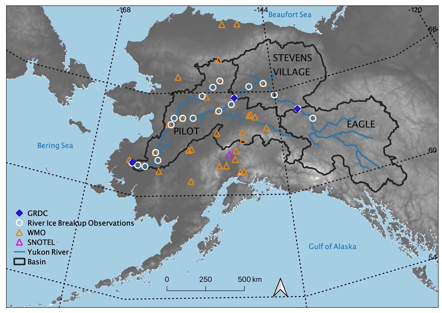
Spatial extent of snowpack main melt onset dataset (MMOD) extending from the Russian Far East across Alaska into Canada's Northwest Territories and British Columbia. The map also includes the GRDC river gauging locations (blue diamonds) used at Eagle, Stevens Village, and Pilot basins (black outlines). Locations of river ice breakup observations (white circles), the World Meteorological Organization (WMO) stations (orange triangles), and SNOw TELemetry network (SNOTEL) stations (purple triangles) are shown. Source: Pan et al. (2021)
Additional Information
| Field | Value |
|---|---|
| Data last updated | April 23, 2025 |
| Metadata last updated | April 23, 2025 |
| Created | April 23, 2025 |
| Format | JPEG |
| License | License not specified |
| Datastore active | False |
| Has views | True |
| Id | ac2ff4da-4559-4312-a775-4a077dadeffa |
| Mimetype | image/jpeg |
| Package id | de752234-589a-48bf-8e2c-1db1a89d2116 |
| Position | 5 |
| State | active |
